
"Is this good ground?"
Some thoughts on what that question means

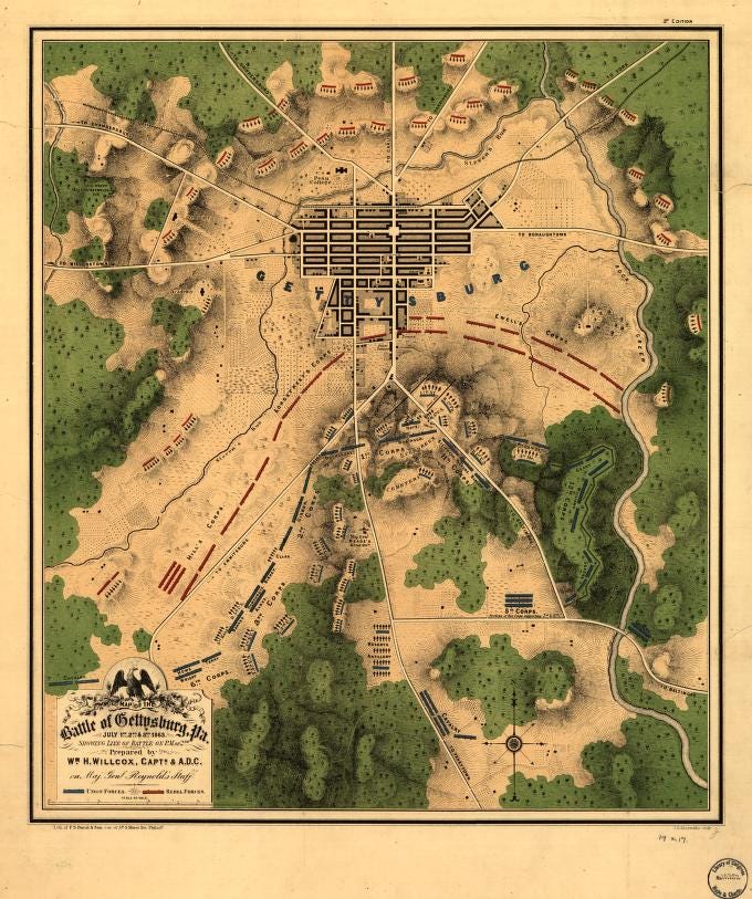
Last July 4th marked Independence Day and the 161st anniversary of the Battle of Gettysburg. Many friends marked this by rewatching the 1993 film “Gettysburg”, a production that drew heavily upon reenactors to fill the screen with the appropriate numbers while also providing a tremendous historical resource. Early in the film, Union cavalry commander General Buford mentions what good ground it is and one of his subordinates replies, “best ground we’ve seen all day.” When General Meade arrives at the farm building that will be his headquarters during his first battle in command of the Army of the Potomac, he asks, “Is this good ground?” General Hancock, II Corps commander, replies, “very good ground.”
In the 1970 film “Waterloo” about the June 18, 1815, battle, the Duke of Wellington responds to a subordinate commander’s complaint about how the woods behind the Army blocks its retreat path, by noting that he had seen this ground a year earlier and ‘put it in his pocket’. Wellington adds that you can move a battery of 6-pounder cannon through the woods. Napoleon shares those doubts about the ground noting that Wellington is “no student of Caesar, he’s got the woods at his back.”
Man being primarily a terrestrial creature, the land plays a central, pivotal role in our wars – as objective, prize, and arena. You can fly over it, you can drive across it, but only when you walk through it can you appreciate the intimate relationship between human combatants and the ground they fight on. Good ground is terrain upon which you can place your troops so that they have an advantage against an attacker. Placing your troops on higher ground means that an enemy has to come up hill to reach them, but not so steep as to make it too hard for your own troops to get up and down and your attacks have the advantage of going downhill. In both of the cited battles, Wellington at Waterloo and the Union Army at Gettysburg occupied a ridgeline that forced their attackers to come up hill to them and enabled both armies to also shelter other troops behind the ridge, protecting them against artillery fire.
Armies fighting in close formations with spears, pikes, axes, and swords preferred open fairly level ground that allowed their tight, close formations of infantry to maneuver without losing cohesion. Open flat ground was also desirable for mounted armies or armies using chariots either to carry a fighter to where they can dismount and fight on foot, as a platform from which to fight, or even as weapons themselves (these especially wanted to fight on open flat terrain).
Battlefields expanded to make room for slings, bows, muskets, rifled muskets, modern breechloading rifles supported by automatic weapons including machine guns. As gunpowder weapons improved in size, caliber, range, their accuracy extended beyond “the whites of their eyes” stage. High ground and open ground offered longer and more open lines of sight from which to see an approaching enemy as soon as possible. The words ‘fields of fire’ were added to the soldier’s vocabulary, soon to be augmented or replaced by ‘kill zone’ or ‘kill box’ to indicate where you expected to be able to shoot with greatest lethal effect at your opponents.
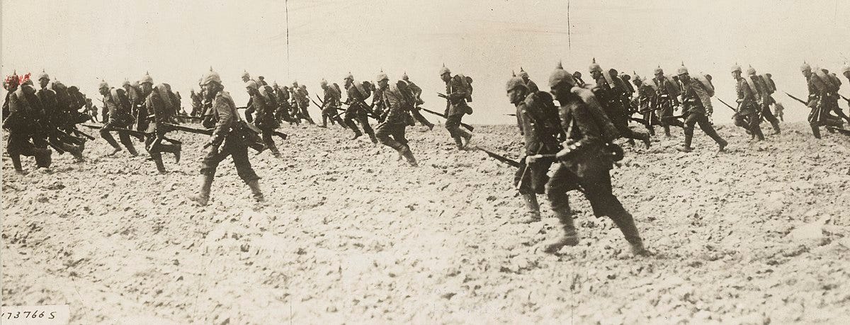
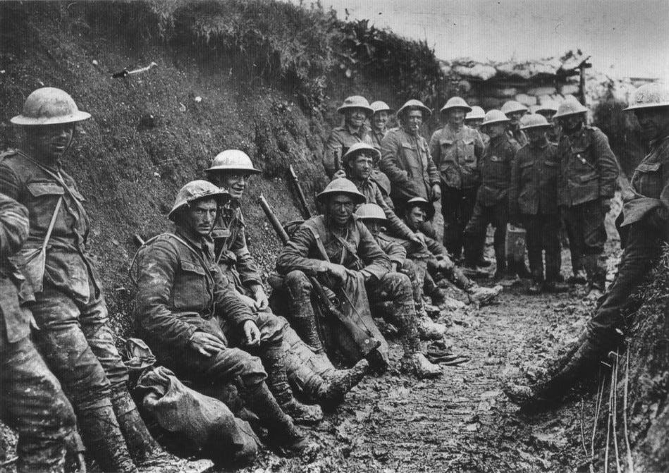
These improvements in infantry weapons also drove changes in formations used by troops on the battlefield. The closely packed lines, columns, and squares gave way to increasingly dispersed ‘formations.’ By 1864, veteran soldiers on both sides of the American Civil War knew how to take advantage of any concealment or cover provided by plant growth or an irregular ground surface – and if there wasn’t a hole already available, they learned to pile up logs and rocks as well as dig fighting holes and trenches (becoming even more intimate with the ground). By the way, concealment is vegetation, uneven ground, rock formations, buildings, etc. that you can hide beyond in order not to be observed by the enemy. Cover is anything you can hide behind that will also provide some degree of protection against enemy bullets or artillery rounds. Modern aerial photography, satellite imagery, and now reconnaissance drones have made concealment both vital and more difficult and cover essential.
Across this same period, cannons, howitzers, and mortars also improved, but for a long time could still only shoot at what their crews could see. That would change with the introduction of modern communications, modern optics, and mapmaking that enabled an observer somewhere else on the battlefield to tell the artillery where and when to shoot – eventually using a grid reference from the maps available both to the gunners and the observer. Beginning in the First World War, the artillery would often reach beyond the infantry’s battlefield and effectively fire at the enemy artillery over the heads of both sides’ infantry. With the arrival of modern aviation, aircraft, drones, rockets, and missiles would enter the airspace above the battlefield and strike at infantry, artillery, vehicles, and even each other to extend the battlefield into a third dimension – the airspace above the troops on the ground. The American Civil War and the First World War had already extended the battlefield into subterranean realms as soldiers dug tunnels beneath the ground and under the opposing army’s trenches and defenses in order to place explosives there and blow up the enemy’s works and the troops in them.
The observer’s ability to communicate with the artillery while located elsewhere reflected the evolution in battlefield communications. Whatever the terrain, commanders needed to see, hear, and be heard as they tried to lead their forces to victory. Thus, ancient battlefields were also limited by how far a commander could see and be seen, hear and be heard. The earliest ‘walkie-talkies’ were horns or drums which over time were provided with an extensive set of ‘tunes’ to play to direct daily life in camp as well as convey orders to an army and its component units on the battlefield.
Modern optics extended the ranges at which armies could see each other and communicate via signal flags, signal lamps, heliographs (a mirror reflecting the sun’s light to flash Morse code style messages). A battlefield commander could now reach out and bring to the engagement units from various distances not yet in the battle, no longer merely hoping they would march to the sound of the guns. But even as these technologies were being applied, the age of electricity provided the telegraph which enabled Lincoln to communicate with his generals and allowed General Grant to coordinate the movement of all Union forces in the last year of the war even as he accompanied the Army of the Potomac to the gates of Richmond. While such capabilities didn’t physically expand a battlefield, it made possible the coordination and control of what happened on multiple, widely separated battlefields. Field telephones, radios, and modern computers supported global telecommunications networks and battlefield communications networks.
Across history, humans have seen fit to share our battlefields with horses, mules, donkeys, burros, oxen, camels, elephants, pigeons, and dogs as transports, to transport messages and couriers across the battlefield, and sometimes as combatants. When ridden by men into battle, horses, camels, and elephants expanded the area of the battlefield only a little as they were quickly fatigued when moving at anything faster than a walk under the burden of rider and his equipment not to mention sometimes armor. We also adopted just about every one of these and other species as mascots and companions.
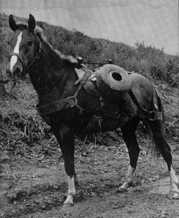
(Sergeant Reckless, carrying communications wire for placement to support US Marine Corps artillery units. Korea, 1953)
Today, we use machines powered by internal combustion engines, turbine engines, and even electric motors to be war machines like tanks, armored cars, and self-propelled artillery, as well as simply for transportation. These vehicles also make use of any concealment or cover offered by irregularities in the ground or from vegetation because today even for these monsters the reality is that if they can be seen they can be destroyed. From World War Two until Desert Storm, most tank on tank battles took place at about 500 yards as weapons sights still relied primarily on the gunner’s eye. It was the larger cannons of late Cold War tanks and their elaborate gunsights with night vision, thermal imaging, and supporting computers that increased combat ranges out to as much as four miles or more in the deserts of Iraq.
Another contribution to artillery’s ability to fire on targets they could not see was the 19th Century explosion in modern mapping. Both armies during the American Civil War had to depend upon experts who would create the maps they needed but even then, governments in Europe had mapping services at work charting their own territory to the benefit of their transport industries and the armies expected to defend the area shown on those maps. A grid system overlain on the map enabled an observer with a view of the target to find the target on his map and then pass a grid reference to the guns (or to higher command) enabling them to find it on their maps. The observer would continue to watch as the rounds fired landed on or near the target and then provide any needed corrections so that the next rounds fired would land in the desired spot. Eventually photographs taken by aircraft and eventually by satellites in orbit would support highly accurate targeting and technology that would provide electronic guidance to weapons flying from half the world away. Various night vision devices enable us to see in the dark and the battlefield is now a 24/7 workplace (even though lots of people already weren’t getting much sleep if they had to do the paperwork or decide what everybody would be doing the next day.)
A battlefield today remains framed by the ranges of the weapons carried by the soldiers on that battlefield. The ranges of these small arms overlap with the longer ranges of supporting heavy weapons – light and heavy machine guns, small and large mortars, man portable anti-tank and anti-aircraft weapons. Also deployed on that battlefield are the instruments of field observation ranging from the Mark I eyeball of individual soldiers augmented by field glasses and supplemented by various technical means working ideally both in light and darkness (thermal imaging, infrared, etc.). When and where there has been time, fighting positions and shelters have been prepared either by supporting military engineers and pioneers or improvised by the soldiers themselves using entrenching tools and found materials. Unit and position commanders have, they would hope, had time to designate fields of fire for the various people and units under the command and coordinated with other longer-range systems not physically located on this battlefield but within range of it. Much of the fighting continues to be in the zone between 25 to 350-500 yards with this mix of weapons – with the soldiers dispersed as much as possible in protected positions. For the longer-range weapons beyond this battlefield, there may even be a predesignated list of targets – points on the battlefield that the commander thinks an attacker might want to use in his approach and actual attack. Such an arrangement can significantly shorten the time of response when the battlefield commander or an observer calls for artillery, rocket, or missile fire from more distant sources.
Battlefields today exist with the echoes of many battlefields of the modern age of gunpowder, even as they continue to be fought beneath nuclear umbrellas and satellite observation. That’s because for a while longer, even as we see drones growing in number and expanding their roles, the vast majority of what happens on a battlefield is still in the hands of the often thinly spread individual soldiers, their NCOs, and their officers. That human element is the real continuity of warfare through the past several hundred years and ultimately everyone in uniform with their personal weapon is an infantryman when ‘the gatling’s jammed and the captain is dead.’